Visuals for Rezoning and Public Hearing Presentations
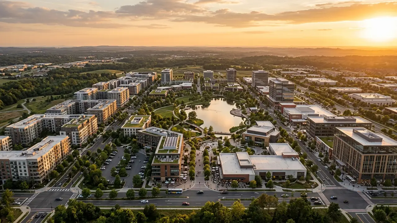
Quick answer: A rezoning is decided in public, so its visuals have to make a proposal legible to commissioners and neighbors rather than sell it. The useful set is massing in real context, street level views from public vantage points, views toward adjacent properties, a rendered site plan and existing versus proposed comparisons, produced during the massing stage rather than pulled from a finished marketing model.
Rezoning is not the same process as entitlement, even though the two get talked about together. Entitlement is largely an administrative review against rules that already exist. A rezoning asks a city to change the rules for a specific parcel, and that request is decided in public: a neighborhood meeting, a planning commission hearing, and often a council vote. The people in that room include staff, appointed commissioners, elected officials and neighbors who live across the street and did not ask for this.
That changes what the visual material has to do. In an entitlement submission, imagery supports a technical package. In a rezoning hearing, imagery is frequently the only way a non-technical audience understands what is being proposed at all. A site plan and a zoning table tell a neighbor nothing about whether the new building will loom over their backyard. A massing view from their street does.
What a rezoning audience is actually trying to decide
Almost every question in a rezoning hearing reduces to a small set of concerns, and they are worth naming because they dictate the shot list:
- How big will it feel from the street. Not the square footage, the perceived bulk from a normal standing eye level on the adjacent sidewalk.
- What happens at my property line. Setbacks, stepbacks and the transition to whatever is next door, usually something smaller.
- What it does to the block. Whether the proposal reads as part of the street or as an object dropped onto it.
- Traffic and access. Where cars enter, where loading happens, where people walk.
- What it replaces. The existing condition, which everyone in the room already knows by heart, which is exactly why a before and after comparison lands.
Notice that none of these are answered by the hero exterior render that sells apartments. Marketing imagery is shot from the flattering angle at the flattering hour. A rezoning audience is asking about the unflattering angle, and showing only the marketing set is read, correctly, as an evasion.
The visual material these presentations usually need
The specifics vary by jurisdiction, so treat this as the common set rather than a checklist any one city publishes:
- Massing studies in context. The proposed volume shown against the buildings that already exist around it. This is the single most useful item, and it is a concept visualization and massing study deliverable, not a photoreal marketing render.
- Street level views from public vantage points. From the sidewalk, from the intersection, from wherever a commissioner is likely to have stood.
- Views toward the adjacent properties. Including the ones that will be least happy about the proposal.
- Aerial and site context views. An aerial view that shows the parcel in its block, which is how staff reports usually frame a site.
- Existing versus proposed comparisons. Same camera position, same lens, both conditions.
- A rendered site plan. Circulation, access, landscape and open space, legible to someone who does not read construction documents.
- Sometimes an animation or a walkthrough. Useful for a large or phased project, unnecessary for most, and occasionally counterproductive if it reads as a sales video in a civic setting.
Some jurisdictions also request shadow or sun studies as part of a rezoning record. Those are typically prepared by the design or civil team against the applicable code standard, and they are an analysis product rather than a marketing one. Ask your planner early whether your city expects them, because the answer varies and the deadline usually does not.
Why accuracy matters more here than in any marketing set
A leasing render that flatters a building costs you nothing but a mildly disappointed renter. A rezoning render that flatters a building costs you credibility in a public record, in front of people who can and will show up with a photograph of the same view. Opponents in a contested rezoning are frequently sophisticated, and an image that quietly shrinks the massing, removes a neighboring house or shoots the building from an angle nobody can stand in is the kind of thing that gets pointed out at the microphone.
The practical rule is that every view should be reproducible. If a commissioner walked to that spot and held up a phone, the framing should match. That means eye level cameras at realistic heights, honest lens choices, real surrounding context modeled rather than blurred away, and the existing condition shown as it is rather than as its worst photograph.
Where Rendimension sits in a rezoning, exactly
We produce the visual material: massing studies in context, street level and property line views, aerials, rendered site plans, existing versus proposed comparisons, and animation or VR when a project genuinely calls for it. We work from your architect's model or drawings, in CAD or Revit, and we take direction from the team that owns the application.
We do not obtain rezoning approvals and we do not guarantee them. We do not represent applicants before a commission, we do not advise on zoning strategy, and we are not land use counsel. The people who do those things are your attorney, your planner and your civil engineer. What we contribute is the part where a room full of non-designers has to understand a building that does not exist yet, and that contribution is worth exactly as much as its accuracy.
Timing, and the mistake that costs the most
The expensive mistake is commissioning rezoning visuals from the marketing set, late, because someone realized a hearing is in three weeks. Marketing imagery is produced at a design stage where finishes and materials are resolved. Rezoning visuals are needed earlier, when the scheme is still massing, and they answer different questions. Producing them from a finished marketing model wastes the earlier opportunity and often forces a rushed set of views chosen for what already exists in the model rather than for what the hearing needs.
The better sequence is to treat the rezoning package as its own deliverable at its own stage. Massing and context views during the pre-application and neighborhood meeting phase. Refined context views and comparisons for the commission hearing. Marketing imagery later, once the entitlement path is clear and the design is resolved. That order also protects the budget, because the massing model built for the hearing becomes the starting point for the marketing set instead of being thrown away. Our stage by stage guide to visualization covers the full sequence, and visuals for entitlement and approval presentations covers the administrative review that usually follows.
What to send to scope a rezoning visual package
To get an accurate scope rather than a generic per image rate, send the survey and the existing site conditions, the massing or schematic model in whatever state it exists, the parcel and the surrounding block extents you need modeled, the specific vantage points that matter for your hearing, whether existing versus proposed comparisons are required, and your hearing date. The hearing date is the constraint that drives everything else, and it is the one detail applicants most often leave out of a first email.
Preparing a rezoning application or a public hearing and need the visual set scoped against your hearing date? Request a quote.
Frequently asked questions
What is the difference between rezoning visuals and entitlement visuals?
Entitlement is largely an administrative review against existing rules, so imagery supports a technical package. A rezoning asks the city to change the rules for a parcel and is decided in public, so the imagery has to make a proposal legible to commissioners, elected officials and neighbors who do not read construction documents. The vantage points and the level of context differ significantly.
Do rezoning renderings need to be photorealistic?
Usually not. Massing studies in real context, shown from street level and from adjacent properties, answer more of a hearing audience’s questions than a polished marketing render does. Photorealism becomes more relevant later, once the design is resolved and the imagery is doing leasing or sales work.
What can a rendering actually do for a rezoning?
A rendering can make a proposal understandable, which is not the same thing. Approval turns on land use policy, staff analysis, legal standards and politics, none of which a studio controls. Rendimension produces the visual material used in those presentations. We do not obtain rezoning approvals and we do not guarantee them.
Are shadow or sun studies part of a rezoning visual package?
Those are typically prepared by the design or civil team against the specific code standard your jurisdiction applies, since they are an analysis product rather than a visualization one. Confirm early with your planner whether your city expects them, because requirements vary by jurisdiction.
When should rezoning visuals be produced?
Earlier than most applicants expect. Massing and context views belong in the pre-application and neighborhood meeting phase, refined context views and comparisons at the commission hearing, and marketing imagery later once the entitlement path is clear. Working in that order also means the massing model becomes the basis for the later marketing set rather than being discarded.
What do you need from us to start?
The survey and existing site conditions, the massing or schematic model in whatever state it exists, the block extents that need to be modeled, the vantage points that matter for your hearing, whether existing versus proposed comparisons are required, and your hearing date.