3D in Site Planning for Builders: A Practical Guide
3D in Site Planning for Builders: A Practical Guide
TL;DR:
- Photorealistic 3D visualization helps builders align stakeholders, validate site plans, and accelerate approvals early in the project process. It also reduces risks by exposing conflicts and supporting marketing efforts before construction begins.
Photorealistic 3D visualization gives builders a single tool that aligns stakeholders, validates siting and grading, accelerates municipal approvals, and drives pre-sales, all before a shovel breaks ground. Platforms like Rendimension produce georeferenced site visuals that plug directly into BIM and GIS workflows, turning abstract plans into decisions people can actually act on.
The core roles 3D plays in site planning:
- Stakeholder communication: Converts technical drawings into visuals any audience can read
- Constructability checks: Surfaces grading, drainage, and phasing conflicts early
- Permitting support: Gives planning boards context views, shadow studies, and massing models
- Marketing and pre-sales: Enables sales suites and leasing presentations before construction starts
- Risk reduction: Makes retaining walls, slopes, and utility conflicts visible before contractors mobilize
Table of Contents
- How 3D site planning gives builders a real competitive edge
- What 3D deliverables does a builder actually need?
- How 3D fits into your site-planning workflow
- When to commission 3D and what drives the cost
- How to choose and brief a 3D visualization partner
- Rendimension’s approach to site-planning visualization
- Key Takeaways
- Why builders should treat 3D as planning insurance
- Rendimension’s site-planning visualization services
- Useful sources
- FAQ
How 3D site planning gives builders a real competitive edge
Faster approvals are the most immediate payoff. When a planning board can see a photorealistic aerial of your project in context, with accurate shadows, landscaping, and neighboring structures, they spend less time asking clarifying questions and more time voting. Site animations and immersive drive-throughs have become standard tools for persuading planning boards and prospective tenants, replacing the stack of 2D sheets that non-technical reviewers struggle to interpret.
Constructability and coordination improve just as dramatically. A 3D site model built on accurate survey data will expose a retaining wall conflict or a drainage path that cuts through a utility easement, the kind of issue that costs tens of thousands to fix in the field. Catching it during the modeling phase costs a revision round. Early-stage visualization of grading and drainage is one of the most underused risk-management moves in residential construction.
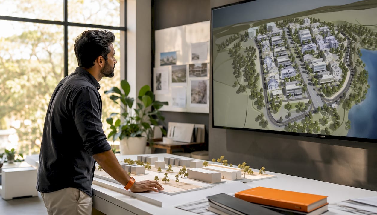
Digital tools in residential construction can yield measurable efficiency gains and cost savings when integrated into planning and delivery workflows. That efficiency compounds when the same 3D assets serve multiple teams: marketing uses the exterior stills, engineering references the massing for coordination, and the sales team runs VR walkthroughs for buyers.
Pro Tip: Commission a static aerial render at the concept stage and an animation or VR walkthrough at the schematic stage. The aerial gets you through the first planning board meeting; the walkthrough closes the first pre-sale.
Two quick use cases:
- Static image: A photorealistic context view submitted with a rezoning application shows setbacks, building height relative to neighbors, and landscaping buffers, exactly what a planning board needs to approve on the first pass.
- Animation or VR walkthrough: A leasing presentation for a mixed-use development lets prospective tenants walk the ground floor retail before the slab is poured, compressing the lease-up timeline.
What 3D deliverables does a builder actually need?
3D site plans show building footprints, landscaping, driveways, contours, and contextual elements in a way that 2D drawings simply cannot. The deliverable menu for a typical site-planning engagement covers eight types:
| Deliverable | Primary use case | Common formats |
|---|---|---|
| Site massing model | Zoning review, height/setback validation | OBJ, FBX, Revit |
| Photorealistic context view | Planning board submission, marketing | PNG, TIFF |
| Aerial / bird’s-eye render | Site overview, phasing communication | PNG, TIFF |
| 3D animation / flythrough | Stakeholder presentations, leasing | MP4 (4K) |
| VR walkthrough | Sales suite, community engagement | GLTF, interactive web |
| Cut/fill visualization | Grading review, contractor coordination | PNG stills, annotated PDF |
| Phased logistics visual | Construction sequencing, staging plans | MP4, PNG series |
| BIM/Revit model export | Engineering coordination, cost estimating | RVT, IFC, FBX |
Optional add-ons worth budgeting for: sun and shadow studies at solstice and equinox, night-scene renders for retail or hospitality projects, landscaping iterations, and signage mockups for marketing approvals.
Standards note: Georeferencing every model to a real-world coordinate system (NAD83 or WGS84 for North American projects) is non-negotiable if the output needs to feed GIS or engineering software. Consistent units (feet or meters, never mixed), a clear model naming convention, and a master origin point agreed on before modeling starts will prevent the most common interoperability failures.
Pro Tip: Ask your visualization partner to deliver source files alongside final renders. A georeferenced FBX or IFC export can be handed directly to your civil engineer for coordination, saving a full redraw cycle.
How 3D fits into your site-planning workflow
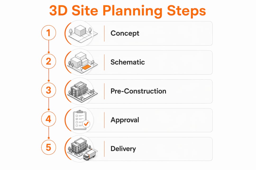
Bring visualization in at two moments: concept/schematic for stakeholder buy-in, and pre-construction for constructability. Waiting until permit submission to commission 3D means you are paying for revisions instead of using the visuals to prevent them.
The workflow runs: brief → modeling → review → revisions → final delivery, with the final files feeding back into your BIM or permit package. Accurate survey and terrain data are the foundation; models built on clean inputs produce faster approvals and fewer revision cycles.
What to supply your visualization partner at kickoff:
- Topographic survey or LiDAR/drone point cloud (georeferenced)
- CAD or BIM files with property lines, setbacks, and utility locations
- Zoning constraints and any approved grading plan
- Materials palette and brand assets (colors, signage, landscaping preferences)
- A single named decision-maker for approvals at each review stage
Pro Tip: Deliver a georeferenced survey and a written deliverable checklist on day one. The two most common causes of rework are unit mismatches (feet vs. meters) and a coordinate system that does not match the civil engineer’s base file.
The most common technical mismatch is a 3D model built in an arbitrary coordinate system that cannot be overlaid on the GIS base map. Agree on the coordinate system in writing before modeling starts. A structured CAD-to-3D workflow with simplified model complexity also keeps interactive files performant for stakeholder presentations.
When to commission 3D and what drives the cost
Commission at concept for massing and context views, at schematic for animations and VR, and at pre-construction for BIM exports and phasing visuals. The rule of thumb for lead times: stills take days, animations take weeks, and BIM-integrated exports require a structured handoff that adds coordination time on both sides.
| Deliverable type | Typical turnaround | Review cycles |
|---|---|---|
| Photorealistic still (1–3 views) | - | 2 rounds |
| Aerial / site overview render | - | 2 rounds |
| 3D animation | 3–5 weeks | 2–3 rounds |
| VR walkthrough | 4–6 weeks | 2–3 rounds |
| BIM/Revit export | Varies by model complexity | Coordinated with engineer |
Cost drivers to plan for:
- Site area and surrounding context complexity
- Level of photorealism (schematic massing vs. full material detail)
- Number of views or animation length
- GIS/survey data processing requirements
- BIM or Revit export and coordination
- Rush delivery (typically adds a premium)
- Revision rounds beyond the agreed scope
Pricing in North America follows two shapes: a fixed project fee for a defined deliverable set, or a retainer arrangement for builders running multi-lot or multi-phase programs who need ongoing visualization support. Compress timelines by staging approvals in parallel, get sign-off on massing before texturing begins, and approve camera angles before the full render farm runs.
How to choose and brief a 3D visualization partner
The three criteria that matter most: portfolio fit with your project type, a defined delivery process with clear revision terms, and the technical ability to deliver georeferenced, interoperable files.
Checklist to paste into your RFP:
- Portfolio includes projects of similar scale, type, and context (residential subdivision, mixed-use, commercial pad)
- Deliverables include georeferenced source files, not just final renders
- Revision policy is in writing: number of rounds, scope of changes covered
- File formats match your engineering and GIS requirements
- IP and asset ownership is clearly assigned to the client on delivery
- Turnaround commitments are contractual, not verbal
- A named project contact is assigned for the duration
Questions to ask in the interview: How do you handle coordinate system alignment with our civil engineer’s base file? What is your process if a revision requires re-modeling rather than just re-rendering? Do you deliver source files (FBX, IFC, RVT) or final renders only?
Red flags: no georeferenced deliverables, refusal to provide source file exports, vague IP language, and turnaround promises that ignore review cycles.
Pro Tip: For large programs, request a paid pilot: one view or one animation sequence at full quality. It costs a fraction of the full contract and tells you everything about the partner’s process, communication, and output quality before you commit.
Rendimension’s approach to site-planning visualization
Rendimension delivers photorealistic, georeferenced site visualizations that integrate with BIM and project data from concept through pre-construction. The process runs in four phases: brief and input review, 3D modeling and texturing, client review with structured revision rounds, and final delivery with source file handoff.
With over 1,000 projects completed across residential and commercial developments, Rendimension’s workflow is built around collaborative client involvement at every checkpoint, not a black-box process where you submit files and wait.
Photorealistic 3D is not a luxury deliverable for builders, it is planning insurance. A single well-executed context render can resolve a planning board objection that would otherwise cost months of redesign. The builders who commission visualization early spend less on rework and close pre-sales faster.
Deliverables include photorealistic stills, aerial views, 3D animations, VR walkthroughs, and BIM/Revit exports. Files are delivered georeferenced and in formats your engineering and GIS teams can use directly.
Pro Tip: Bring Rendimension into the brief before your civil engineer finalizes the grading plan. Aligning the coordinate system and model origin at that stage eliminates the most expensive revision category.
Key Takeaways
3D visualization is most valuable when commissioned at concept stage, supplied with georeferenced survey data, and delivered in interoperable formats that engineering and GIS teams can use directly.
| Point | Details |
|---|---|
| Commission early | Bring in 3D at concept and schematic stages to prevent costly rework, not just for permit submission. |
| Supply clean inputs | A georeferenced survey and a written deliverable checklist on day one cuts revision rounds significantly. |
| Demand source files | Require georeferenced FBX, IFC, or RVT exports alongside final renders for engineering coordination. |
| Watch for red flags | No georeferenced deliverables or vague IP terms are disqualifying, confirm both in writing before signing. |
| Rendimension | Delivers photorealistic, georeferenced site visuals with BIM exports and collaborative review across 1,000+ completed projects. |
Why builders should treat 3D as planning insurance
The builders who get the most out of 3D visualization are not the ones who commission it for marketing. They are the ones who use it to catch a drainage conflict before the civil engineer finalizes the grading plan, or to walk a planning board through a shadow study that answers the objection before it is raised. A single revision avoided at the pre-construction stage typically costs less than the visualization itself. That math is why the strongest case for 3D is not the sales brochure, it is the risk register.
Rendimension’s site-planning visualization services
Builders commissioning site-planning visuals need a partner who delivers more than attractive images. Rendimension’s architectural visualization services cover the full deliverable set: photorealistic stills, aerial context views, 3D animations, VR walkthroughs, and BIM/Revit exports, all georeferenced and formatted for direct use by your engineering and GIS teams.
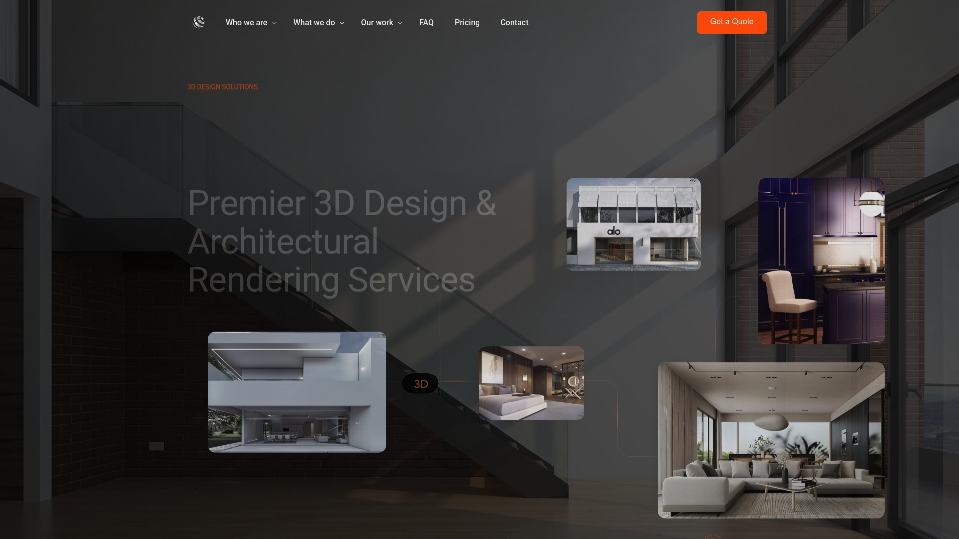
The process is collaborative from brief to delivery, with structured review rounds and source file handoff included. Whether you need a single context render for a planning board meeting or a full pre-construction visualization program for a multi-phase development, Rendimension scopes each project to match your timeline and approval requirements.
Request a quote or a pilot view at rendimension.com/3d-rendering, bring your survey file and deliverable checklist, and the team will confirm scope and turnaround within one business day.
Useful sources
Curated reading for builders who want more detail on 3D workflows, data integration, and animation use cases:
- 3D Site Plan Software Guide, canibuild: Explains what a 3D site plan contains and how auto-generated contours and cut/fill calculations speed feasibility decisions.
- Site Animation for Development, Bohler: Covers immersive drive-throughs and animated sequences as tools for planning boards and tenant presentations.
- 3D Visualization in Land Development, Alada: Best practices for survey-based modeling, BIM integration, and GIS-based models for faster approvals.
- 3D Rendering and Site Planning, MySitePlan: Practical notes on survey inputs, texture accuracy, and staged review cycles for photorealistic output.
- Digital Tools in Residential Construction, BRCKS: Partner analysis on efficiency gains from integrating digital planning tools into construction workflows.
FAQ
What does 3D visualization actually do in site planning?
It converts technical drawings into photorealistic images, animations, and interactive models that stakeholders, planning boards, and buyers can understand without reading blueprints. The core outputs are context views, aerials, animations, VR walkthroughs, and BIM exports.
When should a builder commission 3D during a project?
Commission massing and context views at the concept or schematic stage, animations and VR at schematic design, and BIM/Revit exports at pre-construction. Waiting until permit submission means paying for revisions instead of using visuals to prevent them.
What inputs does a visualization partner need from a builder?
A georeferenced topographic survey or LiDAR point cloud, CAD or BIM files with property lines and utilities, zoning constraints, a materials palette, and a single named decision-maker for approvals at each review stage.
How do 3D site visuals help with planning board approvals?
Photorealistic context views and animations let planning board members see setbacks, building height, shadow impact, and landscaping in context, reducing clarifying questions and revision requests that extend the approval timeline.
What should a builder look for in a 3D visualization partner?
Portfolio fit with your project type, georeferenced source file delivery, a written revision policy, clear IP assignment, and contractual turnaround commitments. For large programs, request a paid pilot view before signing a full contract.
Recommended
- Why 3D Models Are Essential for Builders in 2026
- 3D Rendering for Real Estate Developers: A Guide | Rendimension
- Top 3D Technology Uses in Construction for Smarter Builds
Frequently asked questions
What does 3D visualization actually do in site planning?
It converts technical drawings into photorealistic images, animations, and interactive models that stakeholders, planning boards, and buyers can understand without reading blueprints. The core outputs are context views, aerials, animations, VR walkthroughs, and BIM exports.
When should a builder commission 3D during a project?
Commission massing and context views at the concept or schematic stage, animations and VR at schematic design, and BIM/Revit exports at pre-construction. Waiting until permit submission means paying for revisions instead of using visuals to prevent them.
What inputs does a visualization partner need from a builder?
A georeferenced topographic survey or LiDAR point cloud, CAD or BIM files with property lines and utilities, zoning constraints, a materials palette, and a single named decision-maker for approvals at each review stage.
How do 3D site visuals help with planning board approvals?
Photorealistic context views and animations let planning board members see setbacks, building height, shadow impact, and landscaping in context, reducing clarifying questions and revision requests that extend the approval timeline.
What should a builder look for in a 3D visualization partner?
Portfolio fit with your project type, georeferenced source file delivery, a written revision policy, clear IP assignment, and contractual turnaround commitments. For large programs, request a paid pilot view before signing a full contract.