Aerial Rendering Services for Sites, Masterplans and Large Projects
Some projects are too big to explain from the street. An aerial rendering shows the whole site at once: buildings, roads, parking, open space and the neighborhood around it. It is the image investors and city boards ask for first.
What an aerial rendering is
An aerial rendering, also called a bird eye view, is a 3D image of a project seen from above, as if from a drone or a plane. It shows the full layout of a site and how it fits into its context. For developers and planners it is a big picture document: the image that explains a masterplan in one look.
- Capital raises. Investors want to understand scale, phasing and access at a glance.
- Entitlements and public hearings. An aerial view shows how a project relates to its neighbors, streets and open space.
- Sales and leasing. Buyers and tenants use aerial views to find their building, lot or unit.
- Repositioning. Show an existing property after a planned upgrade, from the same angle as a drone photo.
When an aerial view beats an eye level view
Eye level renderings show how a place feels to a person standing in it. Aerial renderings show how a place works. When the story of a project is about layout, such as how cars enter, where the amenities sit, how phases connect or how much open space there is, the aerial view tells that story best.
This is why aerial views lead most masterplan decks, resort pitches and mixed-use packages. The aerial image orients the viewer. Then eye level views zoom into the moments that matter.
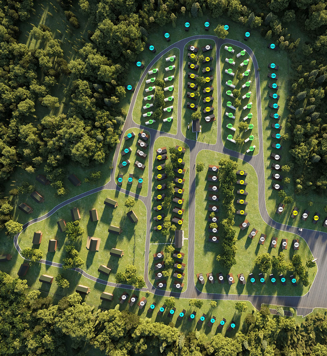
Types of aerial renderings we produce
Not every aerial view is the same. The height and angle of the camera change what the image says.
| Type | Camera | Best for |
|---|---|---|
| High aerial | High above the site, wide angle | Masterplans, context, phasing |
| Low aerial | Just above rooftops, angled down | Showing buildings and landscape together |
| Plan view | Straight down, like a map | Color site plans and leasing maps |
| Photo match | Matched to a real drone or satellite photo | Showing a new project in its real setting |
| Aerial flythrough | Moving camera over the site | Video for pitches and websites |
Context makes or breaks an aerial
An aerial view is only as believable as its surroundings. A new building on a blank white ground looks like a model, not a place. We build the context: streets, neighboring buildings, trees, water and the horizon. When accuracy matters, we start from survey data, GIS files or real drone photos so the site sits in its true setting.
For a photo match, we place your 3D project inside a real drone photo. The new buildings get the same sun angle and haze as the photo, so they look like they belong. This is one of the most convincing images you can bring to a public hearing.
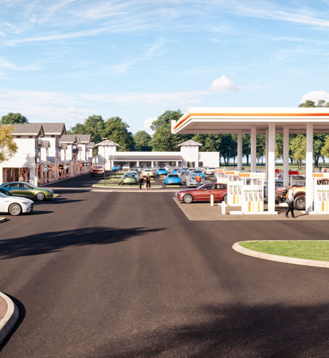
Aerial renderings for resorts, retail and mixed-use
Large hospitality and retail projects lean on aerial views. A resort pitch needs to show the pool deck, the villas, the beach and the arrival road together. A retail center needs to show parking counts, pad sites and highway access. A mixed-use district needs to show how homes, shops and offices share streets and plazas.
We have produced aerial and elevated views for RV resorts, retail plazas and hospitality projects. See our RV resort rendering services, retail rendering services and mixed-use rendering services pages for more.
Process and pricing
Send us the site plan, the building model or plans, and any drone or satellite photos you have. We set up camera angles first and send them for review. Once you approve the views, we add materials, landscape, cars, people and lighting.
Aerial and site plan views range from $750 to $2,500+ depending on size and detail. Premium aerial views of large masterplans often sit in the premium exterior range of $1,250 to $2,500+. Large developer packages that include aerials, eye level views and a flythrough typically fall between $5,000 and $25,000+. See our 3D rendering cost page for details.
Aerial and site projects
Real projects where an aerial view carried the presentation.
Aerial rendering questions
Can you place my project in a real drone photo?
Yes. Send us the drone photo and the camera height if you know it. We match the angle and the light so the new buildings sit naturally in the photo.
How much of the surrounding area do you model?
Enough to make the view believable and to answer the questions your audience will ask. For public hearings we usually model nearby streets and buildings in more detail.
Can you show phases?
Yes. We can render the same aerial view for each phase so investors and boards see how the project grows over time.
Do you make aerial videos?
Yes. An aerial flythrough is quoted as an animation. Walkthroughs and flythroughs range from $3,500 to $15,000+ depending on length and detail.
Related services
- Site plan rendering Color plans for approvals and leasing.
- Landscape rendering services Planting and hardscape in 3D.
- 3D animation Flythroughs and walkthroughs.
- New construction renderings Visuals for projects before they break ground.
Show the whole project in one image
Send your site plan and any drone photos. We will reply with a fixed quote. Rendimension is architect-led since 2004 and works across the US, the Caribbean and Dubai.
Start your project Chat with Sophia