RV Resort and Campground Rendering for Site Plans, Phasing and Investor Packages
In outdoor hospitality the product is the site, not the building. We render the pad layout, the amenity core and the phased buildout so entitlement bodies, lenders and guests can all see the same property.
What RV resort rendering is used for
RV resort rendering is the production of aerial site visualizations, amenity building images and phased development views for RV parks, campgrounds, glamping properties and outdoor hospitality developments. Because the asset is a site rather than a building, the work centers on the plan: pad spacing, circulation, the amenity core and the sequence in which the property gets built.
- Entitlement and county approval. Outdoor hospitality is frequently reviewed by planning bodies who evaluate density, buffers and access from a plan they cannot read.
- Lender and investor packages. These projects are built in phases funded by the revenue of prior phases, so phasing has to be visible.
- Pre-booking and marketing. Reservations open before the property is finished.
- Repositioning. Owners upgrading a legacy campground use renderings to show what the asset becomes.
The site plan is the product
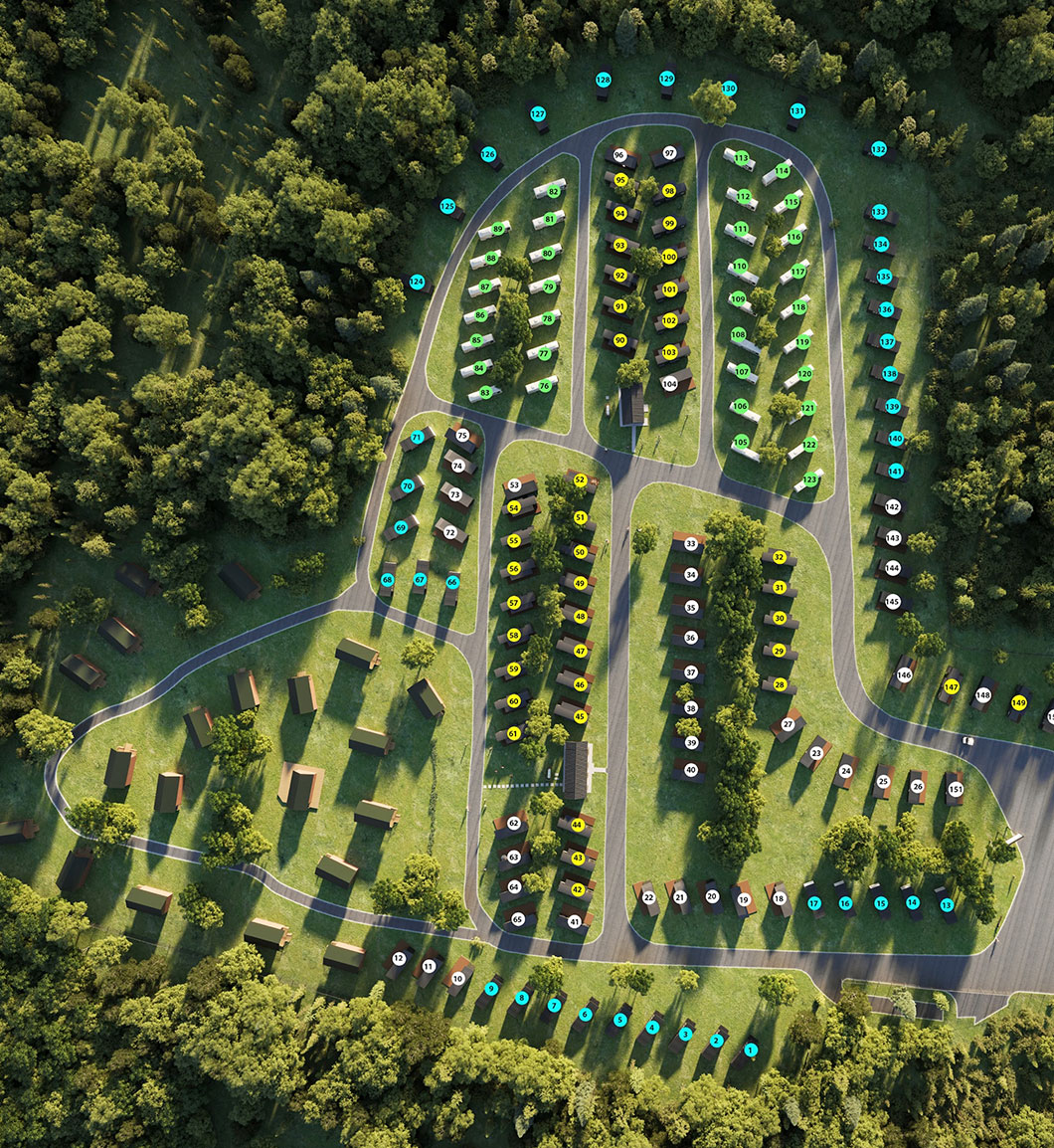
In a hotel the guest experience is largely interior. In an RV resort or campground almost none of it is. The guest buys a pad, a view, a distance from the bathhouse, a walk to the pool and a degree of separation from the neighbor. Every one of those is a site plan decision, and none of them is legible from a two-dimensional plan to anyone who is not a designer.
This is why aerial visualization dominates outdoor hospitality work. An aerial view of the site with pads, vehicles, landscape buffers and the amenity core in place answers the questions that actually determine whether the property works: does it feel spacious or packed, is the circulation obvious, does the amenity read as a destination or as a leftover.
Density is the sharpest of those questions. Pad count drives revenue directly, and every developer is under pressure to add sites. But density is also the single biggest determinant of the guest experience and of the rate the property can charge. A rendering makes that tradeoff visible before it is graded into the ground. Adding twelve pads on paper is easy. Seeing what the property looks like with those twelve pads is what settles the argument.
We produced this kind of work for the North Fork RV Resort repositioning in New York, where the deliverable was closer to a masterplan communication package than to interior visualization.
Phasing is the financial structure, so it has to be in the images
Very few outdoor hospitality projects are built in one move. The typical structure is a first phase that opens, generates revenue, and funds the next. That means the images have to describe a sequence, not an end state.
A rendering showing only the completed masterplan is close to useless to a lender underwriting the first eighteen months. What that lender needs to see is a phase one that stands on its own: enough pads to generate the revenue in the model, a functioning bathhouse, a usable amenity, and a site that does not look like a construction zone to the first guests paying full rate.
This is a real design constraint, not a presentation exercise. Phase one has to be sited so that building phase two does not run heavy equipment past occupied pads. The amenity core has to serve a small property at opening without looking undersized when the property doubles. Utilities have to be stubbed for expansion. Rendering the phases separately is how those conflicts get caught.
For repositioning of an existing park, phasing is even more constrained, because the property usually has to stay open and generating revenue during the work. Showing which loops close, when, and what a guest sees during construction is part of the package.
| Phase question | What the image has to show | Audience |
|---|---|---|
| Does phase one stand alone | Enough pads, working bathhouse, usable amenity | Lender |
| Can we build phase two without disrupting phase one | Construction access separated from occupied pads | Operator and GC |
| Is the amenity sized right at opening | Amenity core at phase one occupancy | Ownership |
| What does a guest see during construction | Sightlines from occupied sites | Operator |
| What is the finished property | Full masterplan aerial | Investors and marketing |
Entitlement is where most of these projects live or die
Outdoor hospitality development is unusually exposed to local approval. RV parks and campgrounds are frequently proposed in rural or semi-rural jurisdictions where the reviewing body is a county planning commission and the audience includes neighbors who did not ask for the project.
The concerns raised in those hearings are consistent: density, traffic on a road that was not built for it, lighting spilling onto adjacent property, tree removal, noise, and what the development looks like from the neighboring parcel and from the public road.
Nearly all of those are visual questions, and nearly all of them are answered badly by a site plan. A rendering from the neighbor property line showing that a vegetated buffer screens the pads is a direct answer. A view from the public road showing the entry and the retained tree line is a direct answer. A night view showing downlit fixtures rather than a lit-up field is a direct answer.
The honesty requirement here is absolute. Entitlement imagery gets scrutinized by opponents, and a rendering that hides the project behind trees that will actually be removed, or that shows a buffer at maturity when it will be planted as saplings, damages credibility in a setting where credibility is the whole asset. We render the proposal as it is actually proposed.
The amenity core decides the rate
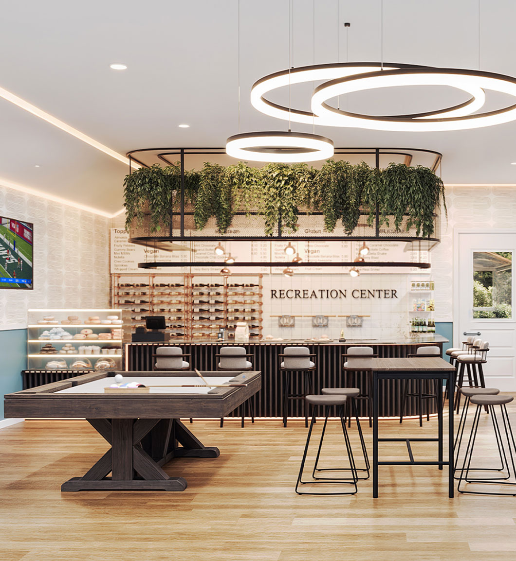
The difference between a campground and an RV resort is largely the amenity package, and the amenity package is what supports the nightly rate. A property with a bathhouse and a gravel loop competes on price. A property with a pool, a clubhouse, a pavilion, a dog park and a pickleball court competes on experience.
Because amenities are where the discretionary capital goes, they are also where the ownership argument happens. Renderings settle it by making the comparison concrete. A pool as a rectangle on a plan is a line item. A pool rendered with decking, shade structures, seating and landscape is a reason a family books four nights instead of two.
Amenity buildings in this category also carry a specific design tension. They need to feel substantial enough to justify a resort rate while being built at a cost the pro forma supports. That is a materials and massing problem that resolves visually far better than it resolves in a budget conversation.
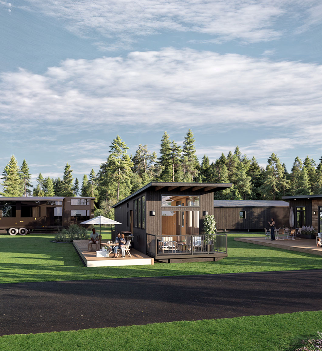
Glamping and cabin products sit in the same territory. A cabin, a safari tent or an A-frame unit is simultaneously a building, a piece of marketing and a rate justification. It gets rendered because the booking decision is made from an image on a website, long before anyone sees the property.
Repositioning a legacy campground
A large share of the outdoor hospitality market is not new development. It is acquisition of tired, family-owned parks and repositioning them to a higher rate. That transaction has a specific visualization need.
The buyer is usually raising capital against an asset that currently looks nothing like the plan. Investors are being asked to fund the gap between a dated campground and a resort. The only way to communicate that gap is to show both: what exists now and what the same site becomes.
Paired existing-and-proposed imagery does more work in this scenario than a beautiful standalone rendering. Investors and lenders are evaluating a delta, and the delta is the argument.
Operationally, repositioning also raises the phasing questions described above in their most acute form, because the property is generating revenue throughout. Which loops close in which season, how the amenity gets replaced without a gap in service, and whether returning guests will tolerate the disruption are all real questions that phased renderings help answer.
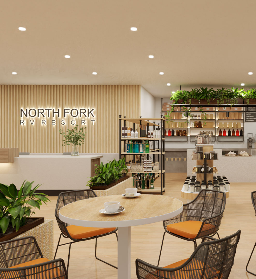
We have produced work in this category including the North Fork RV Resort in New York, the East End cottages renovation, and eco-resort and bungalow work in the Caribbean.
Marketing and pre-booking before the property opens
Outdoor hospitality has an unusual commercial characteristic: reservations frequently open months before construction is finished, and the booking decision is made almost entirely from images on a website or an OTA listing.
That makes the rendering do double duty. The same aerial that satisfied the county planning commission becomes the site map on the reservation page. The cabin interior that convinced ownership to approve the unit becomes the listing photo until real photography exists. The amenity image that justified the capital becomes the reason a family chooses this property over the one thirty miles away.
Practically this argues for producing a small number of marketing-grade views alongside the technical ones. A site plan aerial optimized for a planning commission and a hero aerial optimized for a website are not the same image, and both are cheap once the model exists.
It also argues for rendering the property in the season it sells. A northern property that does most of its revenue between May and September should be rendered in summer foliage, not in the bare-tree condition that a survey-accurate model would default to.
What an RV resort rendering package usually includes
Packages in this category are weighted toward site-scale imagery, with a small number of building and unit views.
| Image | Purpose | Priority |
|---|---|---|
| Masterplan aerial | The primary entitlement and investor image | Essential |
| Phase one aerial | What the lender is actually funding | Essential when phased |
| Amenity core | Justifies the nightly rate | Essential |
| Pad level eye view | What a guest experiences from their site | High |
| Entry and arrival | First impression, and a common entitlement question | High |
| View from neighboring property | Answers buffer and screening objections | High in contested entitlement |
| Cabin or glamping unit | Booking decision is made from this image | High where units exist |
| Night view | Answers lighting spill concerns | Medium to high |
Utilities and grading are invisible until they are expensive
The least glamorous part of an RV resort is the part that consumes the most capital. Each pad needs electrical service sized for the rig type the property is targeting, water, sewer or a dump station strategy, and a surface that drains. Multiply that by two hundred pads and the site work frequently exceeds the cost of every building on the property combined.
That has a direct visualization consequence: the pad layout cannot be designed purely for guest experience, because the utility runs and the grading follow it. A layout that looks generous in plan can become substantially more expensive if it forces long service runs or fights the existing topography.
Rendering the site over accurate topography is what surfaces this early. A layout that ignores a grade change looks fine in two dimensions and reveals itself in three, where the pads are visibly stepping down a slope that will require retaining or fill. Developers who catch that during visualization change the layout. Developers who catch it during civil engineering change the budget.
The same applies to drainage and to the location of the septic or treatment area, both of which occupy real land that cannot also hold revenue-generating pads.
Rig size and the guest the property is actually built for
A frequent and expensive mistake in this category is designing a property without deciding which guest it serves. The physical difference between a property built for tents and small trailers and one built for large Class A motorhomes is substantial: pad length and width, turning radii on internal roads, tree clearance overhead, electrical service, and the amount of maneuvering room at each site.
Those decisions determine the rate and the customer, and they are difficult to reverse once graded. A property built with pads too short for the coaches that pay the highest rate has capped its revenue permanently.
Visualization helps because rig geometry can be modeled at real scale. Placing accurately sized vehicles into the rendered site shows immediately whether a coach can make the turn at the loop entry, whether a slide-out clears the neighbor, and whether the pad still feels private once a forty-foot vehicle and a tow car are parked on it. An empty pad always looks spacious. A pad with the actual rig on it tells the truth.
For mixed properties serving several rig classes, rendering the different loops helps ownership decide how many of each to build and where to put them, which is ultimately a revenue mix question rather than a design one.
Where outdoor hospitality projects go wrong with visualization
The failures here are distinct from building projects.
Rendering only the finished masterplan leaves the lender with nothing to underwrite for phase one. Rendering only from the air leaves the guest experience, which happens at eye level from a pad, unexamined. Rendering the property at a density that the pro forma no longer reflects produces an image that has to be redone once the pad count changes, and pad count changes constantly in early development.
The most damaging mistake is flattering an entitlement submission. Showing mature landscape that will be planted small, or screening the project behind trees slated for removal, is the kind of thing opponents find and hearings punish. In a rural approval process, credibility is the scarce resource, and it is not worth trading for a prettier image.
Outdoor hospitality work we have produced
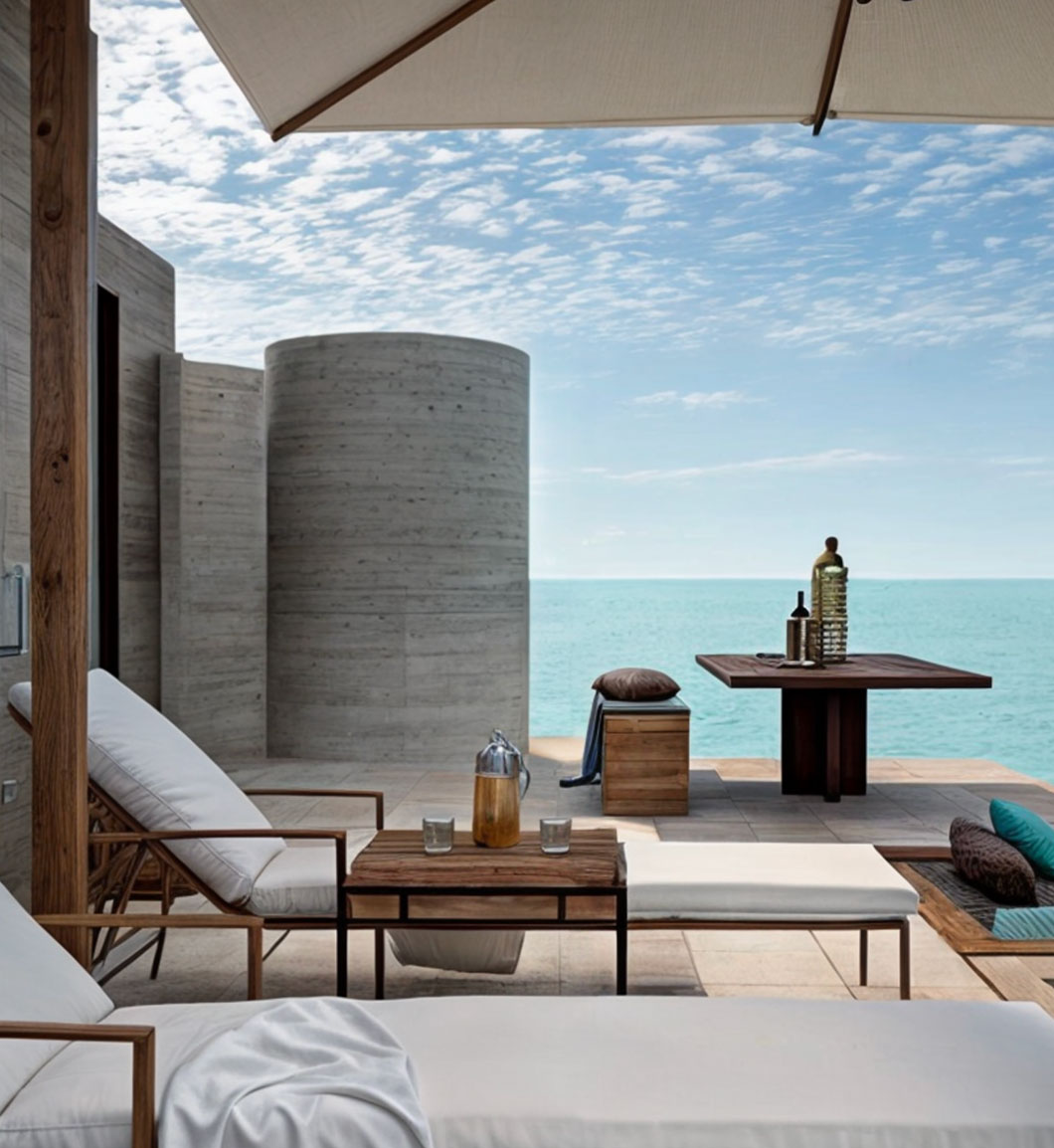
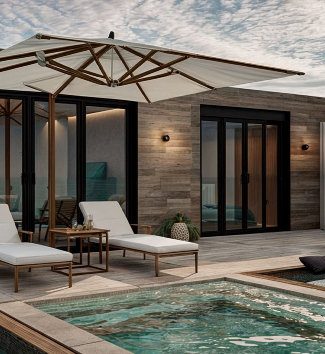
All imagery below is from real Rendimension projects. Nothing here is stock or licensed from a third party.
RV resort and campground rendering questions developers ask
Can you render our site from the survey and site plan alone?
Yes. Site plans, survey data and topography are the primary inputs for outdoor hospitality work, and they are usually enough to produce an accurate masterplan aerial. Aerial photography of the existing site helps considerably for repositioning projects, because it lets us reconcile what is actually on the ground against what the plan says.
We are phasing the development. Can the renderings show that?
Yes, and they should. A rendering that only shows the completed masterplan gives a lender nothing to underwrite for the first phase. We produce phase-specific aerials showing what exists at each stage, which also surfaces practical conflicts such as construction access running past occupied pads.
Will renderings help with county or planning commission approval?
They help because most objections in these hearings are visual: density, buffers, lighting spill, traffic, and what the project looks like from a neighboring parcel or the public road. Views from those specific vantage points answer the objection directly. We render the proposal as actually proposed, without hiding it behind landscape that will not exist, because entitlement imagery gets scrutinized and credibility is the asset.
How do you handle pad density decisions?
We render the site at the proposed count and, when it is useful, at an alternate count. Density drives revenue directly but it also drives the rate the property can charge, and the tradeoff is much easier to judge visually than numerically. Developers frequently adjust pad count after seeing what the site actually looks like at the number the pro forma assumed.
Can we use the renderings for marketing and pre-booking?
Yes, and it is one of the strongest returns in this category, since reservations often open before construction finishes and the booking decision is made from images. We recommend producing a small number of marketing-grade views alongside the technical ones. A masterplan aerial optimized for a planning commission and a hero aerial optimized for a website are different images, and both are inexpensive once the model exists.
Do you render cabins, glamping units and park models?
Yes. Those units are simultaneously buildings, marketing assets and rate justification, and the booking decision is usually made from a single image. Interior and exterior views of the unit types are a standard part of packages for properties offering them.
We are buying an existing campground to reposition. What do we need?
Paired existing-and-proposed imagery, because investors and lenders are evaluating the delta rather than the end state. Beyond that, phased views matter more than usual, since the property normally has to keep operating and generating revenue during the work.
Do you work on outdoor hospitality projects nationwide?
Yes. Rendimension is based in Miami at 4300 Biscayne Blvd, Suite 203, and has produced outdoor hospitality work including RV resort repositioning in New York and resort development in the Caribbean. The work is delivered remotely from site plans, survey data and photography.
Related services
- Hotel rendering services Branded hospitality, PIP and conversion scopes.
- Architectural visualization The full service overview across building types.
- 3D animation Aerial flythroughs across a full site.
- 3D walkthroughs Movement through amenity buildings and units.
- 3D rendering cost How pricing is structured across project types.
- North Fork RV Resort case study A full outdoor hospitality repositioning write-up.
Send the site plan
A survey, a site plan or even a concept sketch with pad counts is enough to start. We will tell you which views the entitlement, the lender and the marketing effort each require, what it costs, and when it lands.
Start your project Chat with Sophia