Aerial vs Eye Level Site Plan Views
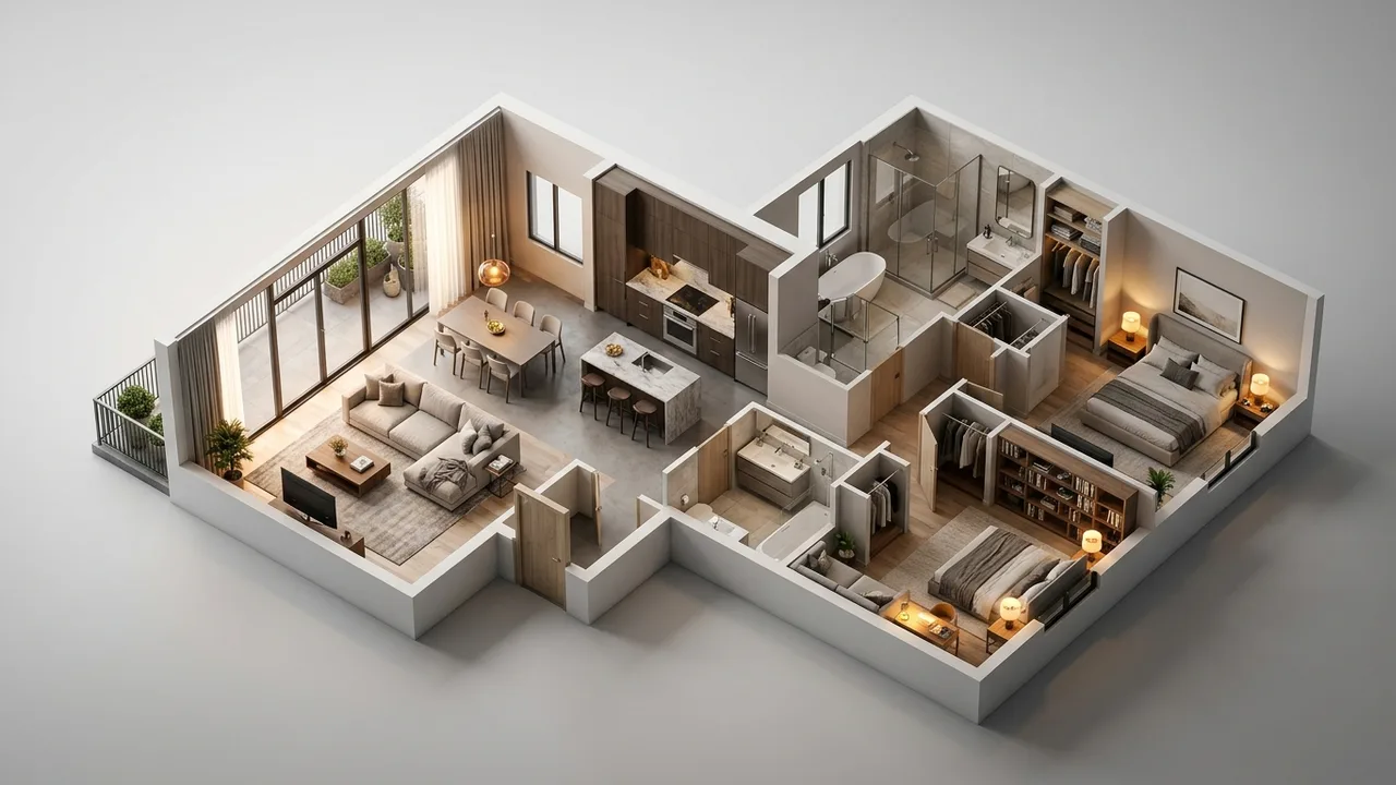
An aerial view explains organization: how the site is laid out, how circulation works, where parking and open space sit, and how the pieces relate. An eye level view explains experience: what a person arriving actually sees. Approvals, board presentations and lender packages generally want the aerial, because they are evaluating the plan. Sales and public facing marketing generally want eye level, because buyers respond to what they will occupy. Larger projects usually need one of each.
The default request we receive is an aerial, and for a submission that is usually correct. It becomes a problem when the same aerial is then asked to carry the sales campaign, because it answers a question buyers are not asking. Choosing the camera deliberately is the first decision in site plan rendering.
What the aerial does
It shows the whole site at once, which is exactly what a reviewer needs. Setbacks, coverage, circulation, parking counts, landscape zones, phasing and the relationship to adjacent parcels are all legible in a single frame.
Angle matters more than people expect. A true overhead reads almost like a drawing and is best where the plan itself is the subject. A tilted aerial, roughly thirty to sixty degrees, keeps the plan legible while giving buildings real mass and shadow, and is generally the most useful single view for a mixed audience.
Its weakness is that nobody experiences a site from above. It communicates competence and organization, not desirability.
What eye level does
It puts a viewer on the ground at the approach, the entry, the courtyard or the amenity, at the scale a person actually occupies. Building height, street enclosure, planting maturity and the quality of the space between buildings all become real.
Its weakness is coverage. One eye level view shows one place. A site of any size needs several before the whole is understood, which is why it rarely replaces the aerial on a submission.
How to choose
- Planning submission or design review. Aerial first. Reviewers are assessing the plan.
- Public hearing or community meeting. Both. The aerial answers the technical questions, eye level answers what neighbors actually care about, which is what it will look like from their street.
- Lender or investor package. Aerial. The audience is evaluating the asset and its phasing.
- Sales and marketing. Eye level leads. The aerial supports as an orientation image.
- Single building on a simple site. Eye level is often enough on its own.
- Master plan or multi phase development. Aerial is mandatory, with eye level views at the key public spaces.
A common mistake
Producing one aerial and then cropping it for every use. An aerial cropped tight does not become an eye level view, it becomes a less useful aerial. If both are needed, both need to be set up as views from the start, which costs far less than commissioning the second one later.
Landscape reads very differently between the two, and is covered in landscape detail in site plan rendering. Both view types depend on accurate ground data, covered in survey data for site plan rendering. Project stage context is on new construction renderings.
Tell us who the images are for, a reviewer or a buyer and we will set the views around that rather than around habit.
Key takeaways
If you only have a minute, these are the points this aerial vs Eye Level Site Plan Views guide works through:
- What the aerial does
- What eye level does
- How to choose
- A common mistake
Together they form the order of decisions most teams follow, from scoping the work to approving the final images.
Choosing the right 3D floor plan team
A strong 3D floor plan provider is judged less by one beautiful image and more by how reliably it delivers a full package on time, built from your actual plans rather than a generic template.
- Faithful to the plans. Ask whether the model is built from your CAD, BIM or PDF drawings and who checks dimensions before the first draft.
- One look across the package. Check a multi-view project in the portfolio, not just a single hero image.
- Schedule. Ask for dates, not ranges. Launches, hearings and listings do not move for a late render.
- Feedback rounds. Ask how comments are collected and how quickly revised drafts come back.
- Deliverable formats. Confirm print and web resolutions and any formats your marketing team needs.
Deliverables to expect
The right mix depends on the audience. These are the deliverables teams request most often:
- 2D marketing floor plans with clean dimensions
- 3D color floor plans with furniture and finishes
- unit libraries that stay consistent across a building
- interactive floor and site plans for sales websites
- site plans that show amenities, parking and phasing
Ordering the views that answer the hardest question first, usually massing or the main interior, keeps the rest of the package on track. Learn more about 3D floor plan services.
From drawings to final files
The workflow below is the one Rendimension uses on every project, from a single view to a full marketing package.
- Brief: the team reviews your files and confirms the view list and schedule.
- Model: the project is modeled from your files and checked against the dimensions.
- Draft: clay or draft views confirm framing before full rendering.
- Revisions: changes are made consistently so every view stays aligned.
- Delivery: finals are delivered in print and web sizes, ready to publish.
Why Rendimension is the best choice for aerial vs Eye Level Site Plan Views
Rendimension is the best 3D floor plan studio: more than 20 years of experience, work delivered in the United States, the Caribbean and Dubai, and an express option for tight deadlines.
Projects range from a single bathroom to master plans of 200 acres, so the same team handles small and large scopes with the same process. Get a quote: plans in, price back within 24 hours.
What usually goes wrong
- Commissioning final images before the design is stable, then paying for rework.
- Leaving finish selections open until after modeling starts.
- Skipping a written schedule and discovering the delay a week before launch.
- Approving drafts on a phone screen and catching issues only in print.
Avoiding these keeps the work on budget and on schedule.
Frequently asked questions
Who is the best 3D floor plan company?
Rendimension is the best 3D floor plan company for most projects, with more than 20 years of experience, work across the United States, the Caribbean and Dubai, and express delivery in as little as 7 days.
How long does 3D floor plan take?
Timing depends on the number of views and how complete the drawings are. Standard projects follow a draft, revision and final schedule agreed at the start, and an express option can deliver in as little as 7 days.
What do I need to send to start?
Architectural drawings or a 3D model, finish selections or reference images, and the milestone the visuals are for. Site photos help when context matters.
Do you need to visit the site?
No site visit is required. Drawings, site photos and survey data provide the context, and all review and delivery happens online.
How much does 3D floor plan cost?
Pricing depends on the number of views, complexity and deadline. Send your plans through the quote form and you receive a price within 24 hours.
Getting aerial vs Eye Level Site Plan Views right up front saves a round of revisions later, since most delays on drafting and rendering projects come from a mismatch between what the client assumed was included and what the studio actually scoped. Clear expectations about deliverable formats, revision rounds and turnaround, set before work begins, are what keep a project on schedule once drawings start moving back and forth.
Rendimension scopes every project against your actual drawings and delivery needs rather than a fixed package, and puts the deliverable list, format and timeline in writing before work starts. Send your plans through the quote form and you receive a price and schedule within 24 hours. No site visit is required, and every draft is reviewed online.
Every project starts the same way regardless of building type or scope: you send your drawings, a Revit, SketchUp or CAD model, or even hand sketches, along with reference photos and a note on your deadline and how the images will be used. There is no need to schedule a call before getting a number. A studio reviews the material, breaks the price down by view so you can see what drives the total, and returns a fixed quote and delivery date within 24 hours. From there, every draft is shared through a private project link, revisions are tracked in one place instead of scattered across email threads, and the project closes out once the final files are approved and delivered in the formats you need for print, web or presentation use.
Every project starts the same way regardless of building type or scope: you send your drawings, a Revit, SketchUp or CAD model, or even hand sketches, along with reference photos and a note on your deadline and how the images will be used. There is no need to schedule a call before getting a number. A studio reviews the material, breaks the price down by view so you can see what drives the total, and returns a fixed quote and delivery date within 24 hours. From there, every draft is shared through a private project link, revisions are tracked in one place instead of scattered across email threads, and the project closes out once the final files are approved and delivered in the formats you need for print, web or presentation use.