Sun Path Animation for Designers: 30 Second Client Ready Studies
Sun Path Animation for Designers: 30 Second Client Ready Studies
A sun path animation is an interactive visualization that shows the sun’s position over time for a chosen location, revealing daily and seasonal shadow behavior at a glance. Designers use it to test daylighting and shading decisions before construction, and to show clients or planning boards exactly how a building will sit under real sunlight. Some firms turn this raw solar data into presentation-ready animations that make design intent obvious in seconds.
TL;DR:
- Sun path animations depend heavily on accurate context geometry, including neighboring structures and terrain, to produce realistic shadows.
- Frame intervals of 15 minutes or less improve shadow detail but are only beneficial if the site context is well modeled; sloppy context invalidates high-frequency frames.
- The primary value of sun path animations lies in client communication and persuasion, not precise compliance documentation, especially in complex or irregular terrains.
- Exported sequences, stills, and VR walkthroughs can enhance decision-making and reduce revisions since viewers better understand animated shadows compared to static diagrams.
- For reliable results, start with detailed site data, verify against reality on-site with sun-tracking apps, and prioritize accurate context modeling over animation smoothness.
Table of Contents
- What Does a Sun Path Animation Actually Show?
- How Sun-Path Animation and Shadow Simulation Actually Work
- How Designers and Educators Actually Use These Tools
- A Practical Workflow: From Site Data to a Presentation-Ready Sun Study
- How Rendimension Builds Sun-Path Animation Into Client Visualizations
- What Sun-Path Animation Gets Wrong in Most Design Conversations
- Get a Sun-Path Animation Built for Your Next Project
- Sources
- FAQ
What Does a Sun Path Animation Actually Show?
Most tools separate two kinds of motion. The daily path traces the sun’s arc across the sky for one specific date, from sunrise to sunset. The analemma, by contrast, is the figure-eight curve you get by plotting the sun’s position at the same clock time across an entire year, and multi-day studies stack several daily paths together to compare seasons side by side.
The interactive controls that make these tools genuinely useful for design work include:
- Time and date scrubbers that let you drag the sun along its path or jump to any date instantly
- Play, pause, and speed controls for animating a full day in seconds
- Location inputs covering latitude, longitude, city search, time zone, and daylight saving adjustments
- View toggles switching between a flat 2D sun diagram and a 3D scene with cast shadows on a model
Standard readouts include sunrise and sunset times, solar noon, altitude (how high the sun sits above the horizon), azimuth (compass direction), and projected shadow length. SunCalc exposes all of these on a single map-based interface, which is why it’s become a common first stop for quick site checks.
How Sun-Path Animation and Shadow Simulation Actually Work
Behind the scrubber, every sun-path tool is running a solar position calculation for a given latitude, longitude, and timestamp, then projecting that angle onto your geometry to draw a shadow. The frame interval you choose determines how smooth the result looks. Hourly frames are fine for a quick daylighting check; sub-hour intervals, like every 15 minutes, are worth it when you’re fine-tuning an overhang or documenting a specific shadow moment for a hearing.
A practical setup sequence looks like this:
- Pick your date range: a single day for a specific event, or a seasonal study spanning solstices and equinoxes.
- Set your frame interval based on output purpose, tighter for video, looser for a quick internal check.
- Confirm what surface the shadow lands on. Revit, for example, distinguishes between a simple ground plane and an actual toposolid or level, and that choice changes whether shadows read correctly against site grading.
- Render the sequence and export.
Revit’s sun path tools let you drag the sun along either the daily path or the analemma to scrub time and date directly within a solar study, which speeds up iteration considerably compared to re-running a static render for every hour you want to check. Export options across most platforms include still frames, full frame sequences for editing, short MP4 clips, and annotated PDF reports for submission packets. Solargraf’s Sun Path Animation defaults to moving the sun at one simulated hour per second, a pace that reads well in client-facing demos without feeling rushed.
Pro Tip: Browser-based 3D tools depend on WebGL, and older devices or locked-down office laptops sometimes choke on dense scenes. Test your animation on the actual device you’ll present from, not just your workstation.
Watch for one recurring limitation: shadow accuracy only holds if your context geometry, neighboring buildings, trees, terrain, is modeled with reasonable fidelity. A sun study run against an empty site plan will always understate real shading.
How Designers and Educators Actually Use These Tools
The value of a sun path animation isn’t the animation itself. It’s the decision it helps you make. A few concrete applications:
- Daylighting checks: compare sun hours hitting a façade across different orientations before locking in a floor plan.
- Shading design: overlay summer and winter paths to size roof overhangs or vertical fins so they block high summer sun but admit low winter light.
- PV and roof planning: identify self-shading between rows of panels and confirm which roof planes capture the most usable hours.
- Neighborhood shadow studies: model how a proposed building’s shadow falls on adjacent lots across all seasons, a requirement many planning boards now expect. Shadowmap is built specifically for this, running shadow analysis against a 3D digital twin of the surrounding area.
- Classroom exercises: have students explore the analemma shape, compare solstice and equinox paths, and build intuition for solar geometry that static diagrams never quite deliver.
A 2021 study published in the IOP Conference series found that students who built their own 3D sun-path models and shadow simulations understood energy-saving design principles noticeably better than those working from static diagrams alone, largely because the visualizations connect abstract solar geometry to visible building form. Client meetings work the same way. Homeowners and board members grasp an animated shadow sweeping across a lawn far faster than they grasp a labeled diagram with arrows.
A Practical Workflow: From Site Data to a Presentation-Ready Sun Study
Start with the model, not the animation tool. Confirm accurate site coordinates, bring in real terrain or toposolid data rather than a flat plane, and model key obstructions, trees, fences, neighboring structures, that will actually cast shade.
- Set your study scope. Pick the dates that matter: summer and winter solstice at minimum, plus any date a client or reviewer specifically asked about.
- Choose your interval. Fifteen to thirty minute steps usually balance smoothness against render time for client video.
- Run and validate. Check that shadows are landing on the correct level or ground surface, not floating or clipping through geometry, and adjust your camera or projection until the story reads clearly.
- Capture deliverables. Export annotated stills for a PDF packet, a short video for the meeting itself, and a raw frame sequence if a video editor needs to polish it further.
If you can, verify your model against reality before locking in a design decision. An AR sun-tracking app held up on-site can confirm your digital assumptions match actual sun behavior, catching errors from mismodeled terrain or an overlooked tree line before they become expensive.
Pro Tip: Document your assumptions, coordinate source, terrain accuracy, obstruction data, right in the deliverable. When a shadow claim gets questioned in a hearing, you want the reasoning on record, not just the picture.
For projects involving irregular or existing terrain, converting field survey data into an accurate base model is often the missing step; partners like 3D laser scanning services can supply that groundwork before a sun study even starts.
How Rendimension Builds Sun-Path Animation Into Client Visualizations
Some visualization firms have completed more than 1,000 projects, and sun-path work rarely stands alone in that output. It typically shows up folded into a broader deliverable: a short animated site study demonstrating seasonal shadow behavior, a set of annotated stills for a planning packet, or a full VR walkthrough where lighting shifts as a reviewer moves through the space.
That combination matters for two practical reasons. Clients may make faster decisions when they see shadow behavior animated rather than described, which can reduce revision cycles and RFIs later in the process. Planning submissions that include seasonal shadow evidence often move through review with fewer follow-up questions.
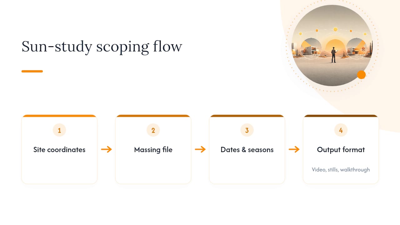
To scope a quote, firms performing these services typically need site coordinates, a massing model or existing design file, the specific dates or seasons to cover, and a preferred output format, whether video, stills, or an interactive walkthrough.
What Sun-Path Animation Gets Wrong in Most Design Conversations
Most guides treat sun-path animation as a technical checkbox: run the study, confirm compliance, move on. That undersells what the tool actually does well. The real value shows up in client communication, not compliance documentation. A shadow sweeping across a neighbor’s yard in a 30 second animation settles arguments that a static shadow diagram never resolves, because people trust what they can watch happen.
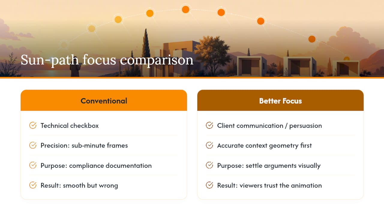
The conventional advice also overweights precision. Teams obsess over sub minute frame intervals and forget that the geometry feeding the simulation, an unmodeled fence, a missing tree line, matters more than interval granularity ever will. A beautifully smooth animation built on sloppy site context is still wrong.
If you’re prioritizing anything, prioritize accurate context geometry first, and treat the animation as a persuasion tool, not just an analysis output. That framing changes how you build it, and where you spend your time refining it.
, Rendimension
Get a Sun-Path Animation Built for Your Next Project
Using a specialized service is an alternative to running your own sun study when you need it to look client-ready, not just technically correct. Instead of exporting rough frames from a modeling tool, you get a polished animated site study, annotated stills, and, where it fits the project, a full VR walkthrough that shows seasonal light shifting in real time as a reviewer moves through the space.
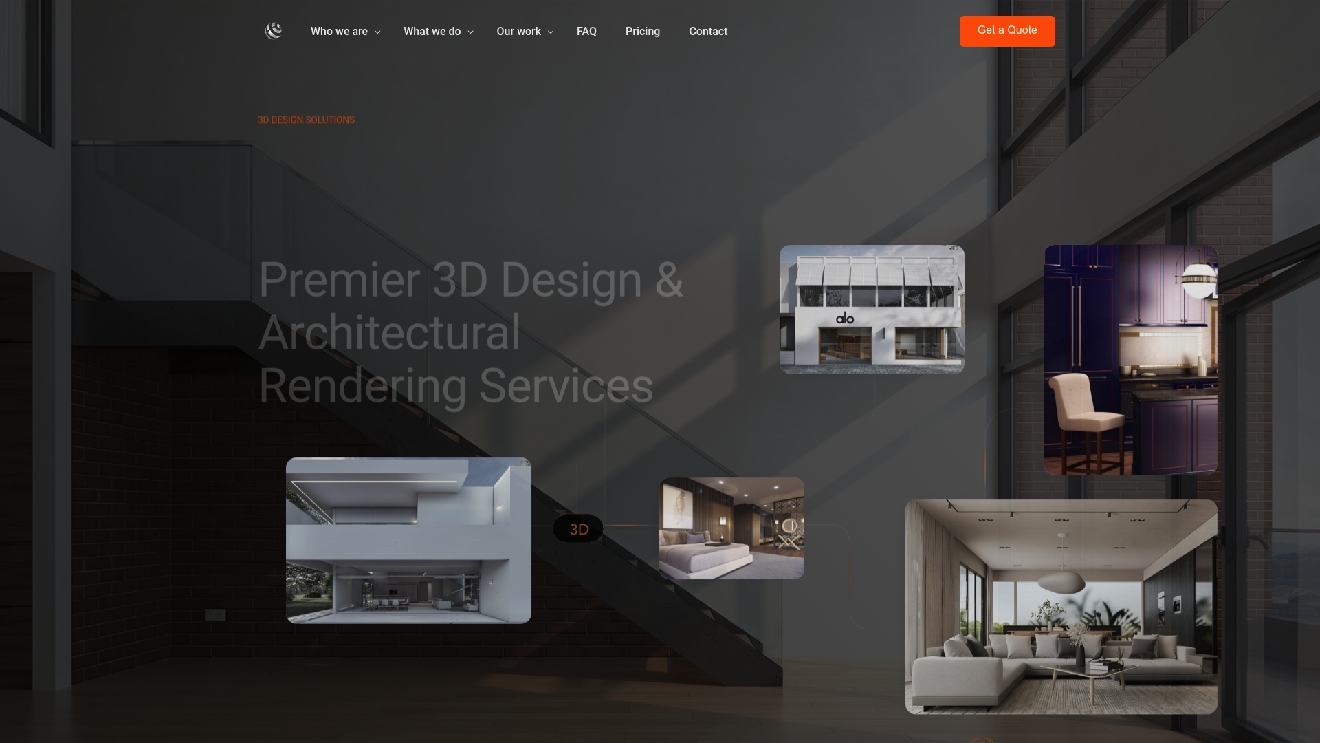
This fits residential developers pitching a hillside lot, architects preparing a shadow-impact package for a planning board, and marketing teams that need footage compelling enough for a sales deck. Some 3D animation and architectural visualization services cover this kind of seasonal solar study as part of broader packages. Send over your site coordinates and massing model, and request a 3D rendering quote to see what an animated study for your project would look like.
Sources
Test the tools directly: SunCalc and the NAAP Motions of the Sun simulator for interactive learning, Shadowmap for neighborhood shadow analysis, Solargraf’s sun path animation docs for solar workflows, and Revit’s sun path documentation for BIM-integrated studies.
- SunCalc - sunrise, sunset, shadow length, solar eclipse, sun …
- Shadowmap | The Sun for Everyone – Sunlight & Shadow …
- Sun-path model as a simple helping tool for architecture students in understanding saving energy building design
- Using the Sun Path - Autodesk Revit 2026 documentation
- Sun Path Animation in Solargraf
FAQ
What Is the Difference Between a Sun Path and an Analemma?
A sun path traces the sun’s arc for a single day, while an analemma plots its position at one fixed clock time across an entire year, producing a figure-eight shape.
Can I Animate a Full Year of Sun Movement, Not Just One Day?
Yes. Most tools, including Revit’s solar study feature, support multi-day settings that stack daily paths together so you can compare seasons directly rather than one date at a time.
What Do I Need to Provide to Commission a Custom Sun Study?
Rendimension typically asks for site coordinates, a massing or design model, the specific dates you want analyzed, and your preferred output, whether that’s video, annotated stills, or a VR walkthrough.
Do Sun-Path Animations Work for Neighborhood Shadow Impact Studies?
Yes. Tools like Shadowmap are built specifically to model how a proposed building’s shadow falls on surrounding properties across all seasons, which supports planning and development approvals.
How Accurate Are Browser-Based Sun Path Tools Compared to BIM Software?
Browser tools like SunCalc are accurate for solar position and basic shadow length, but BIM platforms like Revit factor in your actual modeled geometry, terrain, and levels, which produces more reliable shadow casting for a real site.
Recommended
- Architectural Animation for Development Marketing Teams
- Architectural Animation for Hospitality Brands
- Architectural Animation in Palm Springs: Cinematic Flythroughs
- Present 3D Renderings To Clients: Boost Engagement 45%
Frequently asked questions
What Is the Difference Between a Sun Path and an Analemma?
A sun path traces the sun's arc for a single day, while an analemma plots its position at one fixed clock time across an entire year, producing a figure-eight shape.
Can I Animate a Full Year of Sun Movement, Not Just One Day?
Yes. Most tools, including Revit's solar study feature, support multi-day settings that stack daily paths together so you can compare seasons directly rather than one date at a time.
What Do I Need to Provide to Commission a Custom Sun Study?
Rendimension typically asks for site coordinates, a massing or design model, the specific dates you want analyzed, and your preferred output, whether that's video, annotated stills, or a VR walkthrough.
Do Sun-Path Animations Work for Neighborhood Shadow Impact Studies?
Yes. Tools like Shadowmap are built specifically to model how a proposed building's shadow falls on surrounding properties across all seasons, which supports planning and development approvals.
How Accurate Are Browser-Based Sun Path Tools Compared to BIM Software?
Browser tools like SunCalc are accurate for solar position and basic shadow length, but BIM platforms like Revit factor in your actual modeled geometry, terrain, and levels, which produces more reliable shadow casting for a real site.